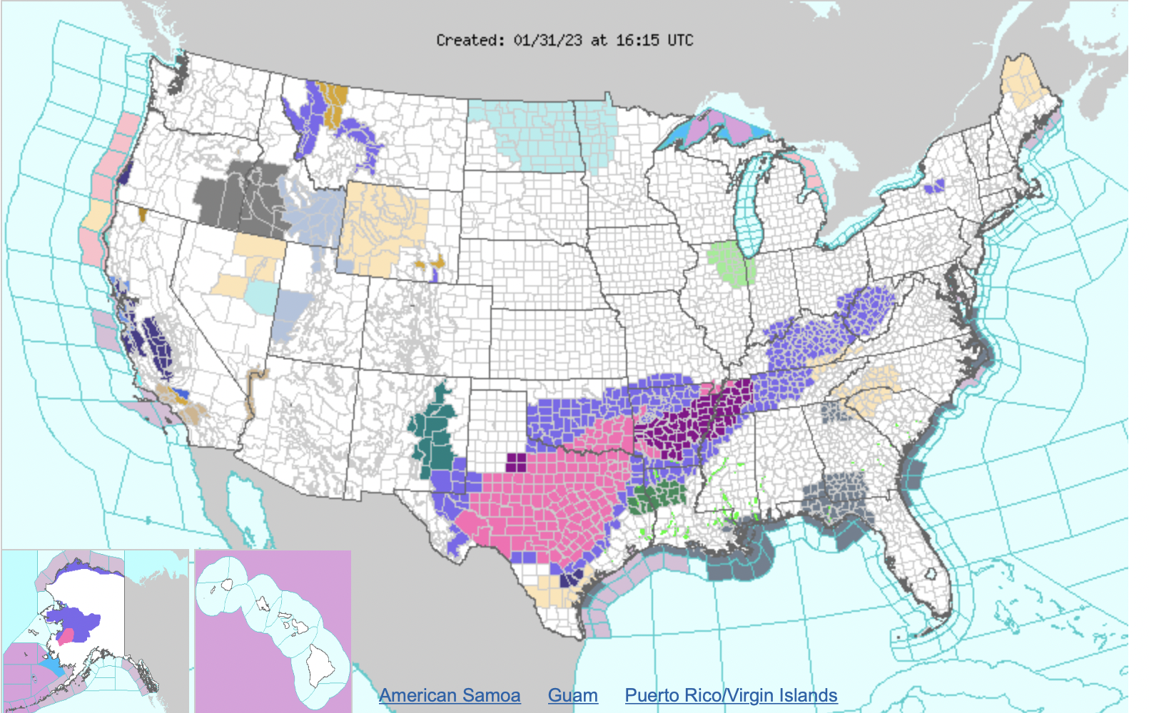
The headlining weather story over the next few days will be the ongoing ice storm affecting portions of the southern Plains and Mid-South that is forecast to continue into at least early Thursday. In the wake of an arctic cold frontal passage, warm and moist air overrunning cold air at the surface draped over the region will produce freezing rain and sleet that could lead to significant impacts. Furthermore, multiple rounds of wintry precipitation are forecast, with brief lulls followed by bursts of sleet and freezing rain that could drastically deteriorate road conditions. Widespread total ice accretion of greater than 0.25″ is likely from West Texas to western Tennessee, with localized areas receiving as much as 0.75″. In addition to potentially hazardous travel conditions, this amount of ice will likely lead to tree damage and scattered power outages across the hardest-hit regions. Sleet accumulations around a half inch or locally higher are also possible from West Texas to Arkansas, which can also lead to treacherous travel or add to the already slippery conditions. As a result, Ice Storm Warnings, Winter Storm Warnings, and Winter Weather Advisories have been issued. Travelers are advised to check road conditions and airline schedules before venturing out and drive with extreme caution. At publication time, over 1,000 flights have been canceled.
The winter storm is forecast to bring icy weather conditions to parts of Western Texas, Southeastern Oklahoma, Southern Arkansas, and West Tennessee. Upward of a quarter-inch to half-inch of ice accumulation is expected along the I-20 corridor in West Texas, stretching eastwards towards I-35 and eventually encompassing the aforementioned additional regions. The storm system has been intensifying since its first signs at the beginning of January, with meteorologists predicting an increase in precipitation by late February.
The NWS has also projected snowfall with this storm system and warns that some areas may experience accumulations of up to 6 inches or more. Sleet is also a possibility for some areas where temperatures will be hovering near freezing levels during storm activity, making travel conditions very dangerous if not avoided altogether. The NWS advises people to limit or avoid outdoor activities if possible during this period, as low wind chills can occur even when air temperatures remain mild.
The NWS forecasts that the storm should pass quickly through the aforementioned regions before departing. However, the aftermath of this event may take time to recede as temperatures drop below freezing at night, leading to frozen surfaces that can cause slick driving conditions over several days following the storm’s departure. It is important for everyone residing in affected areas or traveling through them during this period of time to stay updated on changing weather conditions so they can make informed decisions depending on their circumstances.


