Author Archives: TRO Staff
There are 270 articles by TRO Staff published on this site.
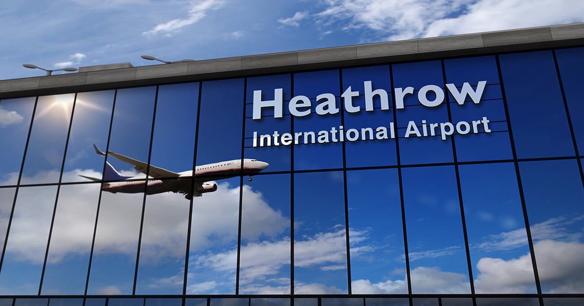
One more time, failed talks with labor unions are disrupting operations at Heathrow Airport.
Striking security officers at Terminal Five have caused British Airways to cancel around 5% of flights for 10 days, from March 31 to April 9 (midnight Easter Sunday), and stop selling new tickets.
For existing customers, the union says the strikes will cause disruption to flights, but Heathrow says it has contingency plans to keep passengers moving along. Still, approximately 1,400 members of Unite who are expected to take part in the walkout will be replaced by 1,000 extra staff being added by the airport.
Elsewhere in Europe, EasyJet cabin crew in Portugal have voted to strike April 1-3, and a wave of strikes by air traffic controllers continues to affect operations in France.
Do you know an adventure enthusiast looking for a travel tour supplier that can fulfill their wildest dreams? Costa Rica Dream Adventures is a perfect choice. Their tours are tailor-made to satisfy the traveler’s thirst for excitement, discovery, and fun. CRDA offers a vast array of activities including canopy tours and ziplining, which will challenge limits and make the traveler’s heart leap with joy.
Read the rest of this entry »Travelers entering the UK next week are being warned to expect delays at border control, as a result of a planned strike by Border Force officials.
The Public and Commercial Services union will be walking out next Wednesday in a dispute over pay. The stoppage is set to last through Thursday morning and will affect all international arrivals at UK air and maritime ports, and those arriving from Calais, Dunkirk and Coquelles in France.
The government has issued a statement urging travelers to prepare for longer wait times at the border during the proposed industrial action. It is recommended that those travelling into the UK during this period plan ahead and allow extra time at check-in to avoid delays or disruption. Furthermore, they have advised travelers to check their airline’s website for more information on their flight status before departing for the airport.
The strike will affect thousands of people across the country, with London Heathrow Airport likely to experience some of the longest queues due to its high volume of international passengers. This could have further implications for domestic flights, with airlines potentially facing staffing shortages due to staff unable to make it through border control in time for their shifts.
The government has urged both sides in this dispute to come together and agree an amicable resolution so that there is no disruption for passengers or businesses affected by these strikes.
Founded in 2016, WeTravel was built to support travel businesses by digitizing and simplifying the travel booking and payment process. Now used by more than 5,000+ clients—to transact with nearly 500,000 travelers and thousands of suppliers, annually— the platform has revolutionized how the travel industry manages their businesses. With a suite of integrated SaaS and FinTech solutions that fit into an intuitive platform, WeTravel enables businesses to increase sales conversion, trim administration time, and manage fund transfers from travelers and to suppliers globally.
Read the rest of this entry »Cruise Lines International Association, the world’s largest cruise industry trade association, providing a unified voice and leading authority of the global cruise community, today announced the appointment of four leaders to helm its Strategic Trade Advisory and Review Board (STARBoard) and Trade Relations Committee (TRC) in North America.
Anita Pagliasso, Vice President of Industry Relations with KHM Travel Group, and Skip Fortier, Vice President of Network Expansion with Avoya Travel, will serve as STARBoard co-chairs. Dondra Ritzenthaler, ECC, Senior Vice President of Sales, Trade Support & Service, The Americas with Celebrity Cruises, will serve as TRC chair, and John Diorio, Vice President, North American Sales with Virgin Voyages, will serve as TRC vice-chair. The two-year terms for the four leaders will run through December 31, 2024. Read the rest of this entry »
A powerful cold front is set to sweep across the entire Northeastern United States by Friday morning, bringing a preview of winter’s chill to the region. As temperatures drop, dangerous wind chills are expected throughout New England and parts of the Northeast, causing the National Weather Service (NWS) to issue numerous wind chill warnings and advisories for the area. Temperatures in New York City and other northeastern cities will hit in the low teens to single-digit temperatures by Saturday but recover by the end of the weekend.
This glancing shot of arctic air comes as part of a larger winter storm system that is follows on the snowfall and icy conditions in Texas and other southern states before it dissipates late Saturday. While this blast of cold weather will not last long, residents can expect extreme conditions in its wake. More than 6,000 flights have been canceled this week as a result of the weather in the deep South. The impact of the Northeastern cold front is likely to be less impactful.
The NWS has warned that anyone venturing outside should dress warmly with multiple layers, hats, scarves, gloves and boots. Residents should also keep an eye out for any signs of frostbite or hypothermia. Wind chills could reach as low as 25 degrees below zero Fahrenheit in some areas on Friday night into Saturday morning due to strong winds gusting up over 30 miles per hour.
In addition to chillier temperatures during this time, travelers may experience significant delays due to hazardous road conditions throughout the region. Motorists should plan extra time if they’re driving near snow-covered ground or icy surfaces such as bridges and overpasses. Extra caution should be taken when driving in these areas as even short periods of exposure at these extreme temperatures can cause vehicles’ tires and brake lines to freeze up.
Further north in Maine, New Hampshire, Vermont and other New England states, residents can expect several inches of snow accumulation along with gusty winds that could make visibility poor at times as well as icy roadways from blowing snow drifts. Meanwhile those living closer to major urban centers such as Boston and New York City are more likely to see rain showers rather than snowfall but still face strong wind gusts which could reach speeds up over 40 mph at times on Friday night.
Power outages may occur in areas where ice accumulates on power lines while flooding or significant sea level rise may occur in coastal communities due to higher tides associated with stronger winds offshore pushing water ashore in a phenomenon known as “storm surge”.
The NWS urges all residents living in impacted states along the East Coast from Georgia through Maine to pay attention and prepare adequately for this upcoming winter storm system before it arrives on Friday morning so they can stay safe during its brief yet potentially dangerous impact through Saturday afternoon.
Social media platform Pinterest has announced the launch of a new program to celebrate Black History Month – the Black Travel Hub. This initiative is designed to provide users with inspiration, education and guidance for travel to destinations across the world. Read the rest of this entry »
The headlining weather story over the next few days will be the ongoing ice storm affecting portions of the southern Plains and Mid-South that is forecast to continue into at least early Thursday. In the wake of an arctic cold frontal passage, warm and moist air overrunning cold air at the surface draped over the region will produce freezing rain and sleet that could lead to significant impacts. Furthermore, multiple rounds of wintry precipitation are forecast, with brief lulls followed by bursts of sleet and freezing rain that could drastically deteriorate road conditions. Widespread total ice accretion of greater than 0.25″ is likely from West Texas to western Tennessee, with localized areas receiving as much as 0.75″. In addition to potentially hazardous travel conditions, this amount of ice will likely lead to tree damage and scattered power outages across the hardest-hit regions. Sleet accumulations around a half inch or locally higher are also possible from West Texas to Arkansas, which can also lead to treacherous travel or add to the already slippery conditions. As a result, Ice Storm Warnings, Winter Storm Warnings, and Winter Weather Advisories have been issued. Travelers are advised to check road conditions and airline schedules before venturing out and drive with extreme caution. At publication time, over 1,000 flights have been canceled.
The winter storm is forecast to bring icy weather conditions to parts of Western Texas, Southeastern Oklahoma, Southern Arkansas, and West Tennessee. Upward of a quarter-inch to half-inch of ice accumulation is expected along the I-20 corridor in West Texas, stretching eastwards towards I-35 and eventually encompassing the aforementioned additional regions. The storm system has been intensifying since its first signs at the beginning of January, with meteorologists predicting an increase in precipitation by late February.
The NWS has also projected snowfall with this storm system and warns that some areas may experience accumulations of up to 6 inches or more. Sleet is also a possibility for some areas where temperatures will be hovering near freezing levels during storm activity, making travel conditions very dangerous if not avoided altogether. The NWS advises people to limit or avoid outdoor activities if possible during this period, as low wind chills can occur even when air temperatures remain mild.
The NWS forecasts that the storm should pass quickly through the aforementioned regions before departing. However, the aftermath of this event may take time to recede as temperatures drop below freezing at night, leading to frozen surfaces that can cause slick driving conditions over several days following the storm’s departure. It is important for everyone residing in affected areas or traveling through them during this period of time to stay updated on changing weather conditions so they can make informed decisions depending on their circumstances.
The final few days of January will feature numerous chances for snowfall across the northern half of the country and mountainous West, with potentially heavy snow leading to travel impacts as bitter cold temperatures surge into more the Nation by the end of the weekend. An initial system traversing the Upper Midwest and Upper Great Lakes this morning will be responsible for light to moderate snowfall and gusty winds throughout the region into tonight. An arctic front will push into the Northern Plains today, moving further into souther states over the weekend.
Winter Weather Advisories and Blizzard Warnings have been issued through midday across the Red River Valley of the North due to additional snow and blowing snow. To the west, a strong arctic cold front pushing south into the northern Rockies will allow for conditions favorable for periods of heavy snow across much of the northern High Plains and central/northern Rockies through this weekend. Snow could be heavy at times and drastically reduce visibility, making travel potentially treacherous. A wave of low pressure forming along the aforementioned frontal boundary is expected to swing eastward tonight into the central Plains and eventually into the Midwest on Saturday.
A swath of moderate to locally heavy snow is forecast to the north of this low, stretching from the Black Hills to southern Michigan. The heaviest snow associated with this system is anticipated to occur from the North Dakota-Nebraska border to the northern half of Iowa, where over six inches of snow is possible along a narrow corridor.
An arctic airmass lurks over much of central and western Canada this morning and will dive southward behind the sinking cold front this weekend. Temperatures 20 to 40 degrees below average are forecast to spread into the northern Rockies and northern/central Plains by Sunday, with highs only reaching into the single digits and lows dropping into the minus teens. Gusty winds will make it feel even colder and could lead to dangerous conditions for individuals spending an extended amount of time outdoors.
Elsewhere, as this same frontal boundary approaches the Deep South on Sunday and stretches northeastward into the Lower Great Lakes, numerous showers and thunderstorms are expected. The cold front is forecast to act as a focus for moisture as a warm and muggy airmass surges back northward out of the Gulf of Mexico, which may lead to thunderstorms capable of containing intense rainfall rates. A Slight Risk (level 2/4) of Excessive Rainfall has been issued from the Upper Texas Coast to the South Carolina Lowcountry, where there exists the best chances for several inches of rain that could lead to scattered flash floods.
For hosted advisors, knowing all the facts about different host agencies is a must. Yet, sometimes the facts found on the host company’s website aren’t the whole story. That’s where Host Agency Reviews will come to the rescue, in specific Host Week 2023. Now in its third year, registration is open for this virtual event featuring notable keynote speakers, offers, and information for advisors of all levels.
Read the rest of this entry »Dangerous mountain travel conditions in the Sierra Nevada range are forecast through this weekend, leading to treacherous journeys and hazardous whiteout conditions. With blowing winds and heavy snow likely to affect roads, highways, and mountain passes throughout the region, travelers are advised to finish their travel plans by 1 pm Friday.
The National Weather Service has issued an advisory warning that dangerous conditions prevalent in the Lake Tahoe high country should be taken seriously. The combination of gusty winds and snowfall could reduce visibility at times. This could create near-zero visibility or “whiteout” conditions with limited visibility due to snow drifts or heavy snowfall. These conditions could cause drivers to lose control of their vehicles and put them in hazardous situations.
Additionally, the NWS is expecting significant accumulations of snow above 7,000 ft., with up to 2 feet possible at some locations by Tuesday morning. Many roads may become impassable as a result of deep snowdrifts obscured by falling snow. This will increase the risk for vehicles attempting to traverse these routes Monday night into Tuesday morning. These include Interstate 80 from Donner Lake down to Truckee, along with Highways 89 & 267 over Brockway Summit from Truckee down toward Tahoe City. Additionally, travel is highly discouraged on Highway 88 around Carson Pass as well as Highway 108 heading over Sonora Pass into Mono County through Monday night..
The NWS also warns those heading out on skis or other recreational activities that avalanche danger could become significant in areas where several inches of new precipitation falls quickly over existing large accumulations of snowpack already present on mountain slopes higher than 7500 ft. Heavy winds also impact avalanche danger and can create areas where collapses are more likely due to increased loading on cornices or slabs of weakly-bonded wind-drifted powder near ridge tops.
Snowfall rates could be quite intense late Sunday afternoon onward through Monday afternoon. Travel plans involving mountain passes or ski resort destinations in the Sierra Nevada range involve dangerous traveling conditions prevailing through Monday night into Tuesday morning.
⚠️Dangerous mountain travel conditions are forecast tomorrow – Monday. If you have travel plans, it will be best to finish your travel by 1 pm tomorrow. Travel is HIGHLY DISCOURAGED through Monday night! Blowing winds & heavy snow will cause whiteout conditions. #CAwx pic.twitter.com/hPn5lfIHDX
— NWS Sacramento (@NWSSacramento) January 12, 2023
On Wednesday, Canada experienced a brief disruption to its aviation warning system, the Notice to Air Missions (NOTAM) system. This system is operated by Nav Canada – a private non-profit organization that owns and operates the country’s air traffic control – and alerts airlines and pilots of potential hazards in the sky. The United States experienced a similar disruption at the same time. The connection, if any, between the two incidents is not clear.
Nav Canada began experiencing problems with entering data into the NOTAM system in the morning hours, which prevented them from sending out updates to airlines regarding any current or upcoming threats. As a result, many flights were grounded until the issue was resolved. Once back online, those affected needed to wait for updated information before they could take off again.
The NOTAM system provides crucial guidance on navigating hazardous airspace and allows for greater efficiency in planning flights since pilots can easily access information about potential risks ahead of time.
Nav Canada indicated no flights were delayed by the disruption and the system was back online by the early afternoon.
— NAV CANADA (@navcanada) January 11, 2023
NAV CANADA continues to investigate the cause of the outage; at this time, we do not believe it to be related to the FAA outage experienced earlier today. https://t.co/GnxLSFLU38
— NAV CANADA (@navcanada) January 11, 2023
New European river cruise operator Riverside Luxury Cruises has announced that it has taken ownership of four additional river vessels from the former Crystal Cruises, in addition to the already-acquired Crystal Mozart. The ships are set to join the fleet starting this spring and will embark on voyages along the Rhône & Saône Rivers as well as the Rhine.
The newly acquired ships include the 106-passenger Crystal Bach (now known as Riverside Bach), Crystal Mahler (now Riverside Mahler), Crystal Debussy (Riverside Debussy), and Crystal Ravel (Riverside Ravel). Both the Riverside Debussy and Riverside Ravel will be ready to welcome guests when they launch their inaugural trips Spring 2023. However, those eager to experience a voyage aboard the Riverside Bach or Riverside Mahler will have to wait until 2024, when these vessels debut.
This latest acquisition is yet another move for the new German river cruise operator setting out to expand its selection of vessels with added amenities and state-of-the-art facilities. Each ship offers spacious lounges and cabins with high ceilings, staterooms with balconies, a fitness center, a spa area, a library, and multiple dining venues.
The news comes just months after Crystal Cruises filed for bankruptcy due to financial struggles aggravated by travel restrictions during the coronavirus pandemic. Crystal ceased operation in January 2022, and the Riverside acquired ships did not sail during 2022.
The Federal Aviation Administration (FAA) has grounded all flights in the U.S. following a computer system glitch. The Notice to Air Missions (NOTAM) system, which provides operational information to flight operations, “failed” Wednesday morning. Systems are being restored. However, once fully operational, there will be delays as flights resume and metered into the air.
4,000 Flight Delays and 500 Cancelations at this time.
This is a breaking story and will be updated.
The President has been briefed by the Secretary of Transportation this morning on the FAA system outage. There is no evidence of a cyberattack at this point, but the President directed DOT to conduct a full investigation into the causes. The FAA will provide regular updates.
— Karine Jean-Pierre (@PressSec) January 11, 2023
Update 5: Normal air traffic operations are resuming gradually across the U.S. following an overnight outage to the Notice to Air Missions system that provides safety info to flight crews. The ground stop has been lifted.
We continue to look into the cause of the initial problem
— The FAA ✈️ (@FAANews) January 11, 2023
Update 4: The FAA is making progress in restoring its Notice to Air Missions system following an overnight outage. Departures are resuming at @EWRairport and @ATLairport due to air traffic congestion in those areas. We expect departures to resume at other airports at 9 a.m. ET.
— The FAA ✈️ (@FAANews) January 11, 2023
Update 3: The FAA is still working to fully restore the Notice to Air Missions system following an outage.⁰⁰The FAA has ordered airlines to pause all domestic departures until 9 a.m. Eastern Time to allow the agency to validate the integrity of flight and safety information.
— The FAA ✈️ (@FAANews) January 11, 2023
While some functions are beginning to come back on line, National Airspace System operations remain limited.
Delta Airlines’ new partnership with T-Mobile will offer free in-flight Wi-Fi to all SkyMiles members beginning February 1st. This is an expansion of the existing agreement between the two companies, which offers free Wi-Fi on Delta flights to T-Mobile subscribers.
This new service will provide SkyMiles members with unlimited access to in-flight Wi-Fi, allowing passengers to stay connected while in the air. Passengers will be able to use their phones, tablets, or laptops while they travel without worrying about running out of data or paying for additional services. Additionally, this free service allows users to surf the web, check emails and social media, watch videos and listen to music – all for free during their flight.
In addition to providing free Wi-Fi access for its passengers, Delta Airlines also plans to leverage this new partnership with T-Mobile by offering targeted advertising opportunities for companies looking to reach customers at 35,000 feet. Companies wishing to leverage this opportunity will be able to reach consumers through direct advertisements on their devices as well as through sponsored content that is provided by Delta and T-Mobile’s partner network.
The announcement of the new partnership between Delta Airlines and T-Mobile has been met with enthusiastic approval from frequent flyers.
A powerful and devastating atmospheric river continues to bring torrential rains to California on Thursday, threatening flooding in the Golden State. The extreme weather system, known as a bomb cyclone, is expected to cause major issues in the area and could be accompanied by extremely heavy snowfall rates of up to 3 inches per hour above 5000 feet. This high rate of precipitation may make travel difficult or impossible in parts of Northern and Central California.
These conditions are likely to make for dangerous and, at times impossible, travel in the region’s mountainous terrain. Furthermore, considerable flooding impacts can be anticipated in California’s coastal areas and the Sacramento Valley, as rain rates are predicted to top 1 inch an hour – leading to rapid water rises and mud/rock slides.
This storm system, commonly referred to as a ‘bomb cyclone’, is set to unleash a multitude of extreme weather events across the state. Such events include heavy snowfall, fierce winds, and torrential downpours, which could easily cause life-threatening floods due to the saturated ground from recent rainfall. Moreover, meteorologists stress that this bomb cyclone is intensifying quickly and will bring sustained torrential rain over a long period of time – increasing the risk of landslides and flash flooding substantially.
Airlines have not yet issued travel waivers for the storm.
In addition to its severe weather conditions, this storm is also highly anomalous when compared with historical records. The National Weather Service revealed that such a phenomenon hasn’t been seen since December 2018 – making it almost two years since a similar event has occurred in California; adding further concern regarding its destructive potential. It is recommended that people living or traveling within impacted regions take precautionary measures during this period of extreme weather in order to remain safe throughout the duration of the storm system.
The winter season brought chaos to airports across the United States as Southwest Airlines canceled thousands of flights at the last minute, leaving hundreds of thousands of travelers stuck in limbo. Many passengers were left with no way to get to their destination or any knowledge of where their luggage may be.
What a mess. This is the Southwest Airlines baggage claim at Tampa International. There’s 24 more Southwest flights canceled this morning. Many tags on these stranded bags are from travelers from Denver, Houston and Baltimore @BN9 pic.twitter.com/4C6XFA9eib
— Angie Angers (@angie_angers) December 27, 2022
Southwest passengers can file lost luggage claims here: https://www.southwest.com/help/baggage/lost-damaged-baggage
This travel season was expected to be one of the busiest since before the pandemic, and airlines had already been preparing for higher traffic. But when treacherous winter storms hit, all major airlines had no choice but to cancel or delay flights due to safety concerns. Then, the Southwest “meltdown” compounded the situation.
The process is slow going, with thousands of bags still unaccounted for across multiple airports. While there are some suggestions from experts on how travelers can keep track of their belongings while traveling during bad weather, most customers have found themselves in limbo while they wait for Southwest’s customer service centers to help them out.
In response, Southwest Airlines has issued a statement apologizing for any inconvenience caused and assuring customers that they are doing everything they can do help get luggage returned quickly and safely. They’ve also created a dedicated team of workers assigned solely to helping these lost luggage cases. In addition, many airport personnel have stepped up to provide additional assistance.
We’ve let our Customers and Employees down, and we pledge to do everything we can to make it right. If you still need assistance rearranging your travel, getting a refund, or tracking down your luggage, please visit https://t.co/II3YgdPy7J. pic.twitter.com/64Fdt8jJPn
— Southwest Airlines (@SouthwestAir) December 29, 2022
The U.S. Department of Transportation has created a dashboard to ensure the traveling public has easy access to information about services that U.S. airlines provide to mitigate passenger inconveniences when the cause of a cancellation or delay was due to circumstances within the airline’s control. A green check mark on the dashboard means an airline has committed to providing that service or amenity to its customers. A red “x” means the airline has not made that commitment. However, airlines with a red “x” may provide these services and amenities in some instances in their discretion.
The Dashboard and additional information can be found here: https://www.transportation.gov/airconsumer/airline-customer-service-dashboard
See also:
https://www.transportation.gov/individuals/aviation-consumer-protection/flight-delays-cancellations
On Friday, millions of Americans were hit by an unprecedented winter storm with bone-chilling temperatures, blizzard conditions, and widespread power outages causing serious disruption to holiday plans. The winter weather affected more than 60% of the U.S. population with warnings or advisories from California to New England and as far south as Florida.
The impact on air travel was particularly severe, with FlightAware reporting almost 4,800 flight cancellations within and into the United States, in addition to over 7,700 delayed flights. This has caused huge disruption for travelers trying to make it home for the holidays. Cancellations are likely to continue into Saturday and beyond due to weather-related delays.
In many states hundreds of thousands of homes have been left without power due to high winds bringing down trees onto power lines; emergency services have been overwhelmed by calls; roads were closed due to flooding or blocked by snow drifts; and schools were forced to close early before their Christmas break began.
Local authorities are providing shelter for those without electricity or running water, offering advice about how best cope with any disruptions caused by snow or flooding, as well as spreading messages about staying indoors during blizzards or avoiding flooded areas during storms such as this one.
Most major carriers have changed their policies regarding flight cancellations and rebooking fees due to extreme weather conditions associated with this event. It is important that customers check with their airline beforehand so they can understand any potential waiver policies if their flight is canceled or significantly delayed due to this weather system over the coming days.
Travelers are strongly advised against leaving last minute preparations until nearer to departure time as there may be additional disruptions if another significant snowfall occurs in a particular location during peak times.
Winter Storm Elliott is poised to bring an array of severe weather conditions, including snow, wind, and bitterly cold temperatures, across the United States. The storm could have a serious impact on holiday travel over the next few days, and experts are advising travelers to remain flexible and have a backup plan in place.
Some 26 states are under wind chill warnings, and the National Weather Service is advising of “record-breaking low temperatures”. This comes when air travel is expected to be higher than it has been in 20 years. According to Airlines for America (A4A), a trade organization comprising major airlines, more than 64 million passengers are expected to fly between Saturday, December 21st, and Tuesday, January 1st. While airports will be bustling with activity during this period, many flights may end up delayed or canceled due to Winter Storm Elliott’s effects.
The storm is predicted to move from west to east and could lead to blizzards, icy roads, and below-freezing temperatures across much of the country. According to the National Weather Service (NWS), 17 states will likely experience winter storm warnings by Friday evening. The NWS also anticipates that extreme cold will accompany this storm system as it moves through the Midwest and into the Northeast regions of the United States. Temperatures in some areas have already dropped into single digits as far south as Texas.
Travelers are being urged not only to be mindful of flight cancelations and delays but also hazardous driving conditions due to icy roadways and reduced visibility caused by blowing snowfall.
Those who do decide to brave Winter Storm Elliott should remain updated on any changes via their airline’s websites or mobile apps as well as local media outlets for real-time information about potential delays or closures along their routes; they should also keep an open mind when making any travel plans – allowing extra time for delays rerouting if necessary.
A Wind Chill Advisory is in effect, as the combination of very cold temperatures and brisk west-to-northwest winds will produce wind chills of 20 below to 30 below zero. Temperatures early this week will be 15 to 25 degrees below average. The arctic blast is expected to bring life-threatening temperatures and major travel disruptions across parts of the United States over the next few days. With snow forecasted in areas from the Midwest to the Northeast, air travelers should brace for delays and cancellations as airports struggle to keep up with the demand. Those planning on flying may expect delays or cancellations due to the arctic weather situation unfolding across the country at present.
A surge of Arctic air behind a cold front crossing the U.S. through the week will bring widespread, dangerous wind chill temperatures through much of the central U.S. and a potential flash freeze from the mid-South to the East Coast. A major winter storm will form on this front bringing heavy snow and high winds creating blizzard conditions for parts of the Plains into the Great Lakes. Strong winds will hit “nearly the entire eastern half of the U.S. as this large system becomes fully mature by Thursday night.
The cold snap is caused by an extended high-pressure system stretching from western Canada toward the northern Plains. According to the National Weather Service, this powerful arctic system will bring “very cold air” across a wide area, with potential record lows expected in some areas.
In some states, temperatures will drop into the single digits and even below zero Fahrenheit—dangerously low levels that can lead to hypothermia or frostbite if exposed for too long. In anticipation of these extreme conditions, several states have already issued warnings, with many local governments offering advice on how best to stay safe in such frigid weather.
Airlines are already taking preventative steps—such as adding extra flights and additional staff—to limit potential delays or cancellations due to bad weather. Amtrak has also shifted its schedule ahead of any possible weather disruptions. Those expecting to fly can expect turbulence along their journey, as freezing temperatures can make it harder for aircraft to ascend or descend quickly enough.
In addition, snowfall associated with this storm could further hinder travel plans in cities like Detroit and Chicago, where roads are known to get overwhelmed during winter. Road crews may be dispatched around town to help clear away any snow buildup, but commuters should still plan for longer trips than usual when traveling through these regions during a snowstorm.