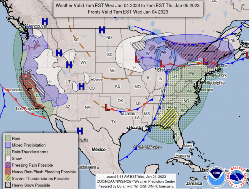
A powerful and devastating atmospheric river continues to bring torrential rains to California on Thursday, threatening flooding in the Golden State. The extreme weather system, known as a bomb cyclone, is expected to cause major issues in the area and could be accompanied by extremely heavy snowfall rates of up to 3 inches per hour above 5000 feet. This high rate of precipitation may make travel difficult or impossible in parts of Northern and Central California.
These conditions are likely to make for dangerous and, at times impossible, travel in the region’s mountainous terrain. Furthermore, considerable flooding impacts can be anticipated in California’s coastal areas and the Sacramento Valley, as rain rates are predicted to top 1 inch an hour – leading to rapid water rises and mud/rock slides.
This storm system, commonly referred to as a ‘bomb cyclone’, is set to unleash a multitude of extreme weather events across the state. Such events include heavy snowfall, fierce winds, and torrential downpours, which could easily cause life-threatening floods due to the saturated ground from recent rainfall. Moreover, meteorologists stress that this bomb cyclone is intensifying quickly and will bring sustained torrential rain over a long period of time – increasing the risk of landslides and flash flooding substantially.
Airlines have not yet issued travel waivers for the storm.
In addition to its severe weather conditions, this storm is also highly anomalous when compared with historical records. The National Weather Service revealed that such a phenomenon hasn’t been seen since December 2018 – making it almost two years since a similar event has occurred in California; adding further concern regarding its destructive potential. It is recommended that people living or traveling within impacted regions take precautionary measures during this period of extreme weather in order to remain safe throughout the duration of the storm system.


