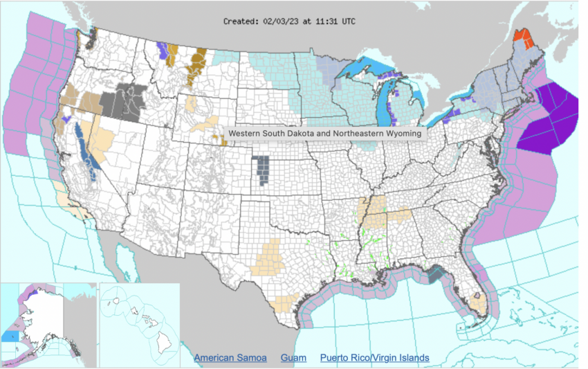
A powerful cold front is set to sweep across the entire Northeastern United States by Friday morning, bringing a preview of winter’s chill to the region. As temperatures drop, dangerous wind chills are expected throughout New England and parts of the Northeast, causing the National Weather Service (NWS) to issue numerous wind chill warnings and advisories for the area. Temperatures in New York City and other northeastern cities will hit in the low teens to single-digit temperatures by Saturday but recover by the end of the weekend.
This glancing shot of arctic air comes as part of a larger winter storm system that is follows on the snowfall and icy conditions in Texas and other southern states before it dissipates late Saturday. While this blast of cold weather will not last long, residents can expect extreme conditions in its wake. More than 6,000 flights have been canceled this week as a result of the weather in the deep South. The impact of the Northeastern cold front is likely to be less impactful.
The NWS has warned that anyone venturing outside should dress warmly with multiple layers, hats, scarves, gloves and boots. Residents should also keep an eye out for any signs of frostbite or hypothermia. Wind chills could reach as low as 25 degrees below zero Fahrenheit in some areas on Friday night into Saturday morning due to strong winds gusting up over 30 miles per hour.
In addition to chillier temperatures during this time, travelers may experience significant delays due to hazardous road conditions throughout the region. Motorists should plan extra time if they’re driving near snow-covered ground or icy surfaces such as bridges and overpasses. Extra caution should be taken when driving in these areas as even short periods of exposure at these extreme temperatures can cause vehicles’ tires and brake lines to freeze up.
Further north in Maine, New Hampshire, Vermont and other New England states, residents can expect several inches of snow accumulation along with gusty winds that could make visibility poor at times as well as icy roadways from blowing snow drifts. Meanwhile those living closer to major urban centers such as Boston and New York City are more likely to see rain showers rather than snowfall but still face strong wind gusts which could reach speeds up over 40 mph at times on Friday night.
Power outages may occur in areas where ice accumulates on power lines while flooding or significant sea level rise may occur in coastal communities due to higher tides associated with stronger winds offshore pushing water ashore in a phenomenon known as “storm surge”.
The NWS urges all residents living in impacted states along the East Coast from Georgia through Maine to pay attention and prepare adequately for this upcoming winter storm system before it arrives on Friday morning so they can stay safe during its brief yet potentially dangerous impact through Saturday afternoon.


